|
Fire
in the Pines - May 15 - 16, 2007
See Map
May
15 "BLOG"
May
16 "BLOG"
May
17 "BLOG" - After the Fire
MAY
17 PHOTOS - The Day After the Rain
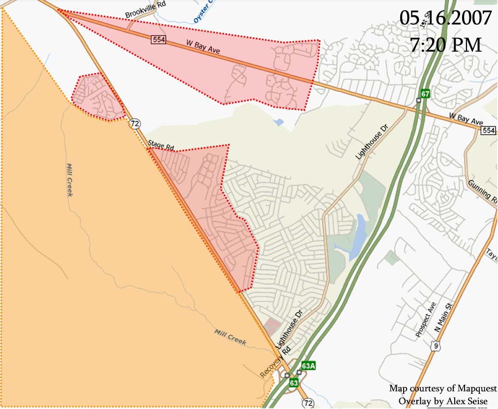
MAP
OF EVACUATION AREAS (all
areas are now safe)
Courtesy of Alex Seise
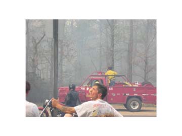
May
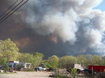
15 Photos
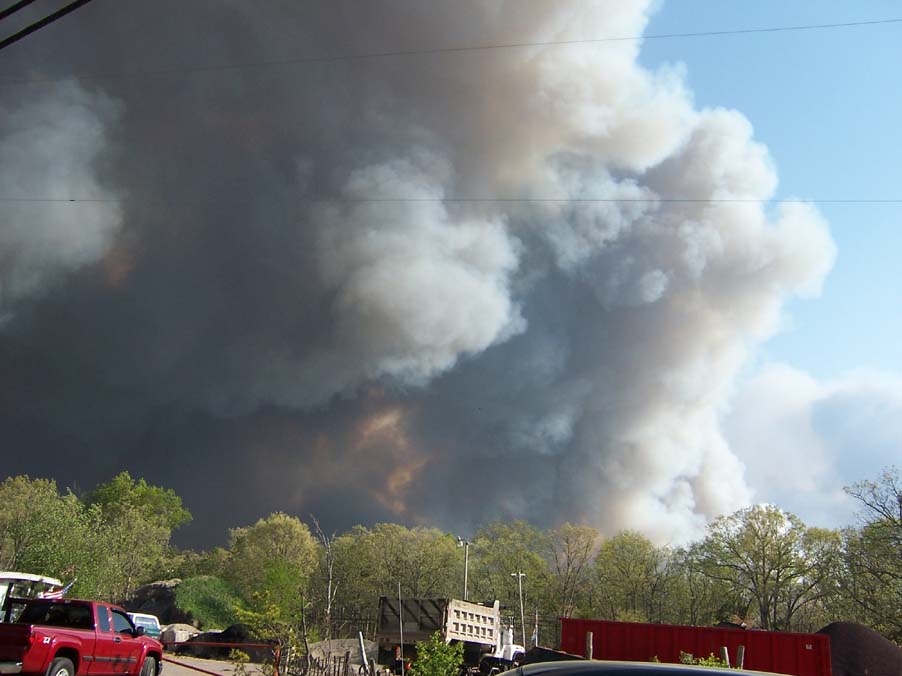
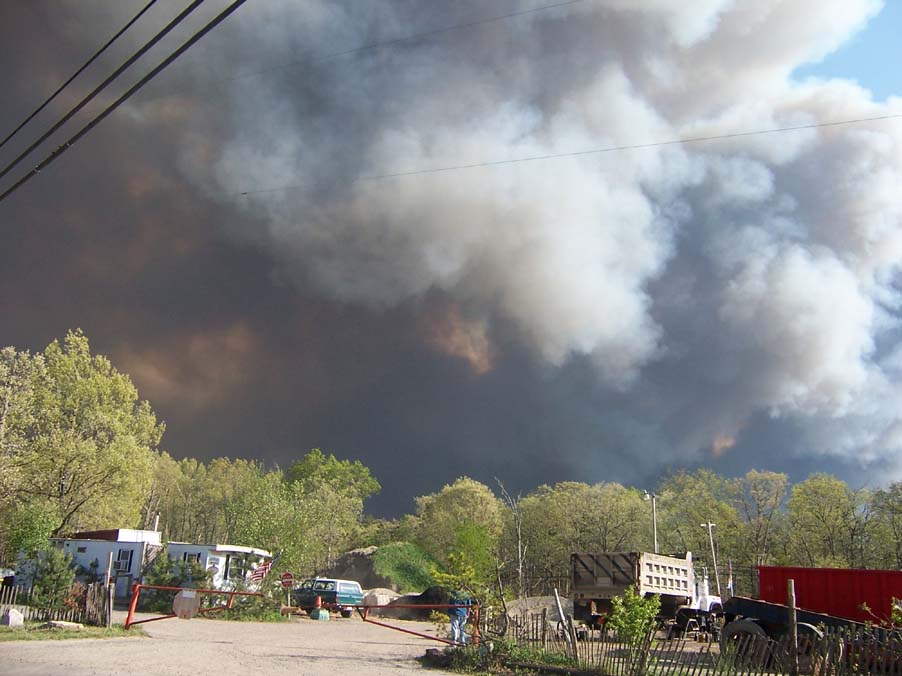
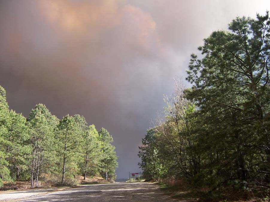
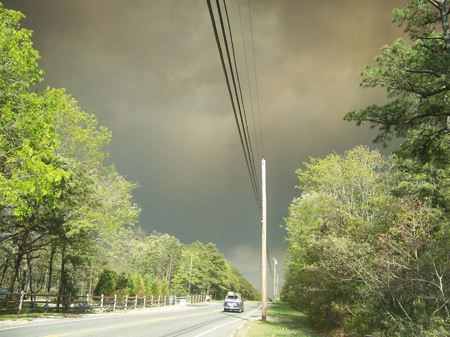
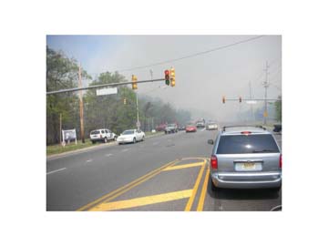
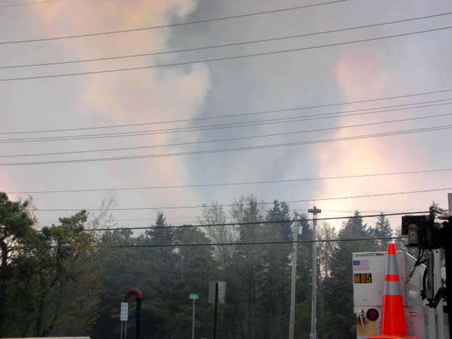
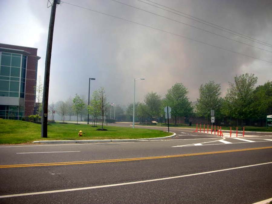
The
photos below were taken on May 15th from West Bay Ave near
Route 72 in Barnegat NJ. News 12 NJ states 2,500 acres have
already been affected, that the fire may have started at the
Warren Grove Gunnery Range off Route 539, and has reached
Stafford Forge. It is warm and windy today, with no rain forecast
until possibly tomorrow, which is hindering firefighters.


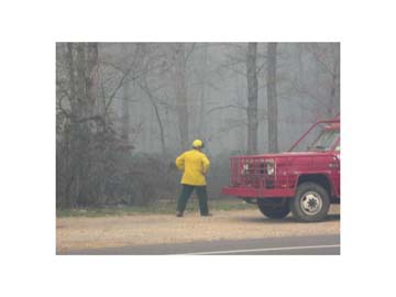
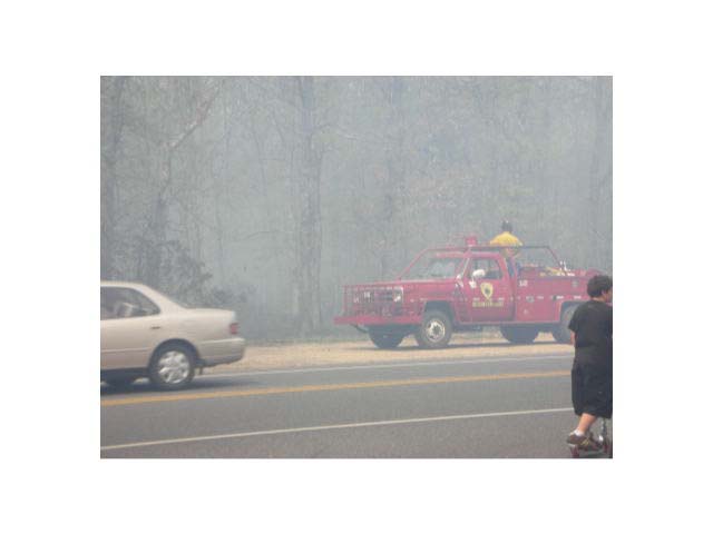
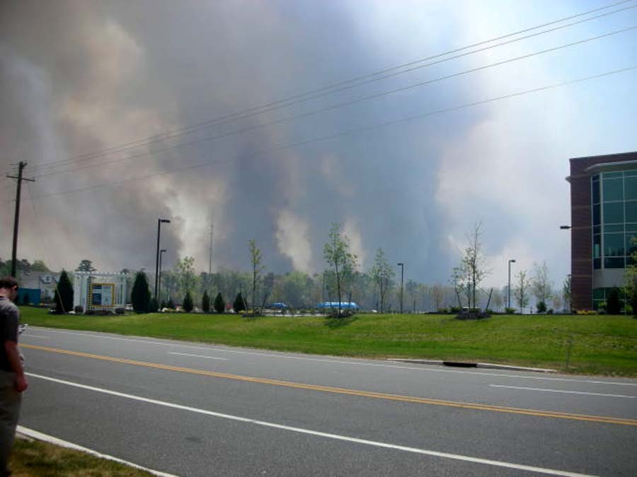
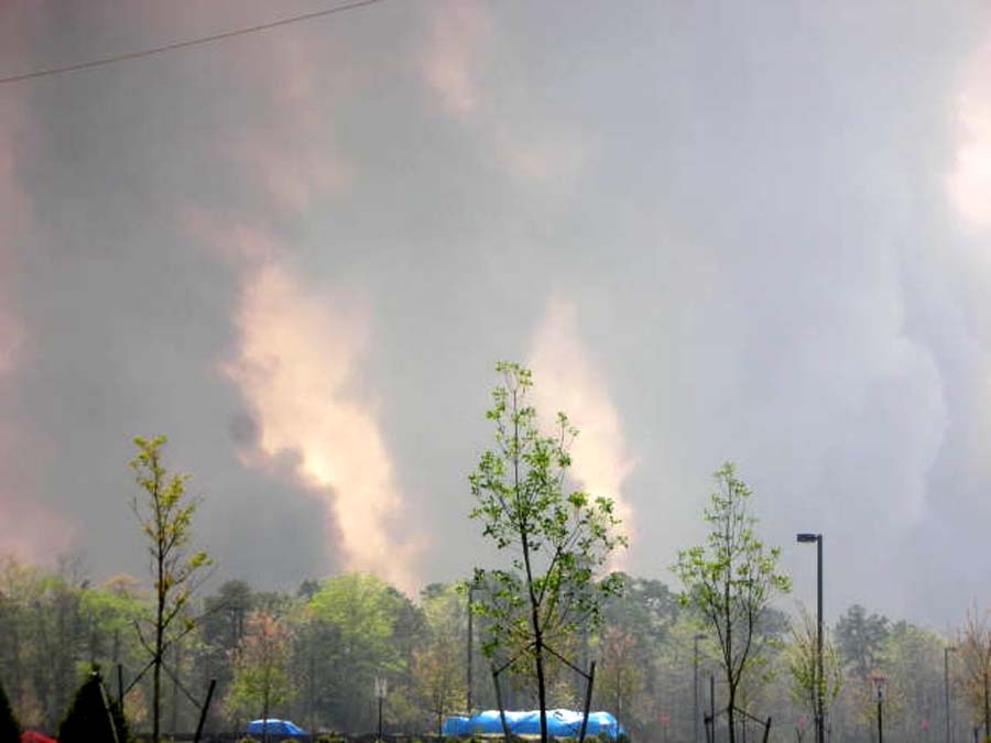
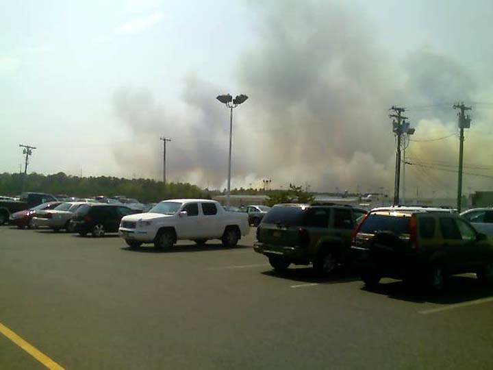
May
16 Photos Below
(Click
on photos for larger view)
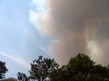
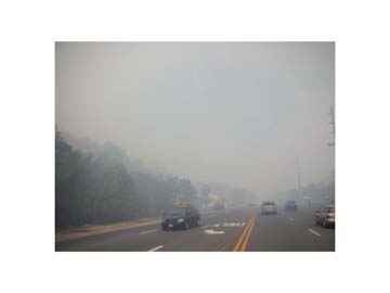
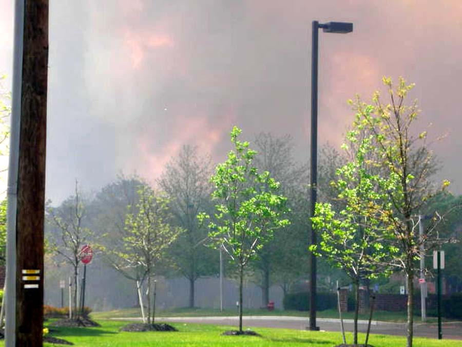
The above photo was taken at about 1:00p.m. on May
16 from my rear yard, which is about 1/2 mile west
of the Garden State Parkway.
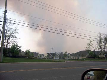
This photo was taken at about 1:30p.m. May 16, showing
Horizons Adult Community on the south side of West Bay
Ave. in Barnegat.
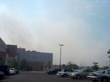
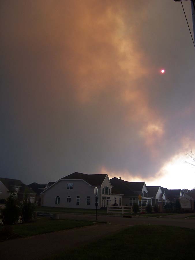
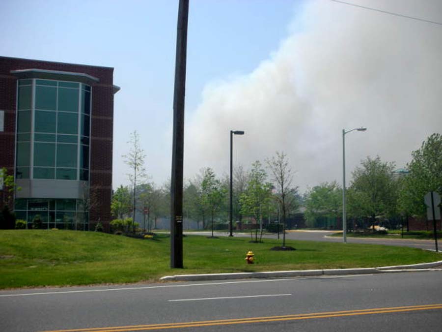
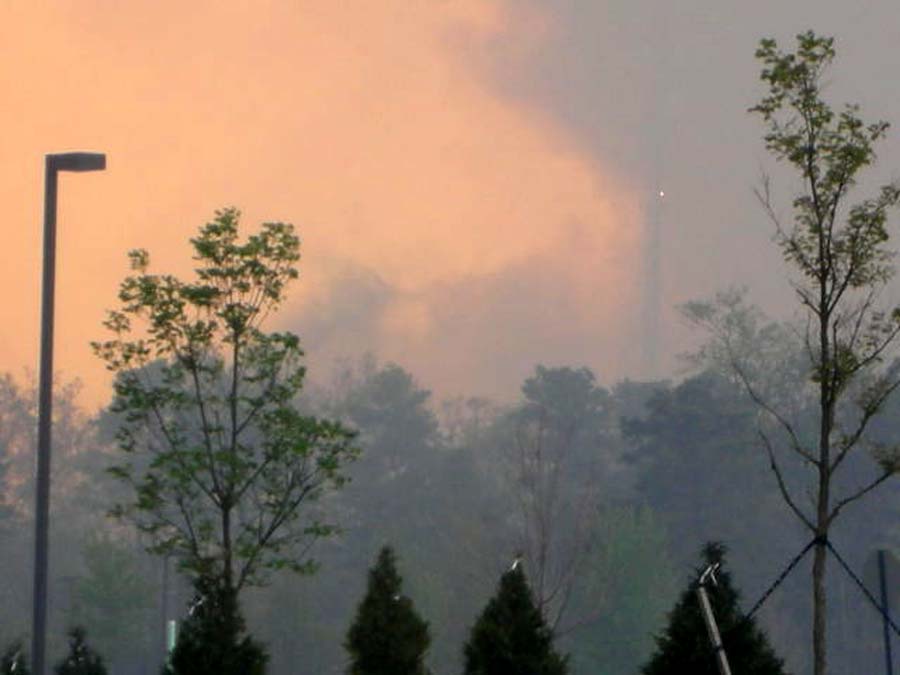
Southern
Ocean Community Hospital, located on Route 72 &
Nautilus Drive, earlier today. This photo was taken
looking southeast.
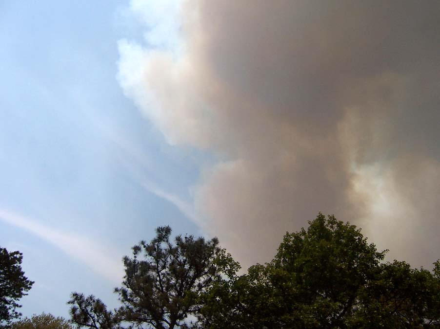
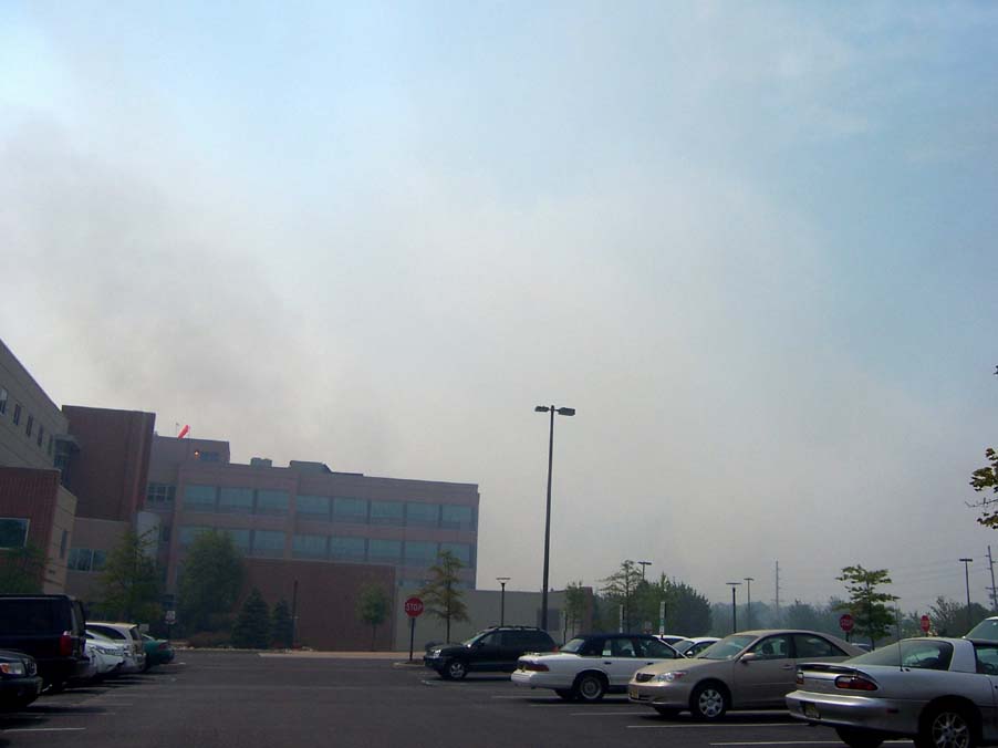
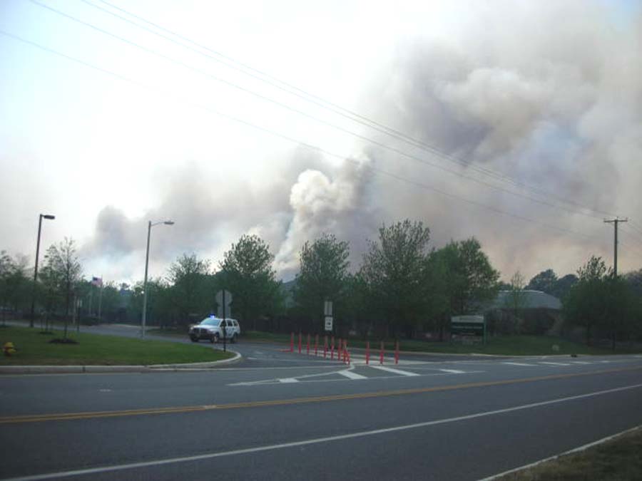
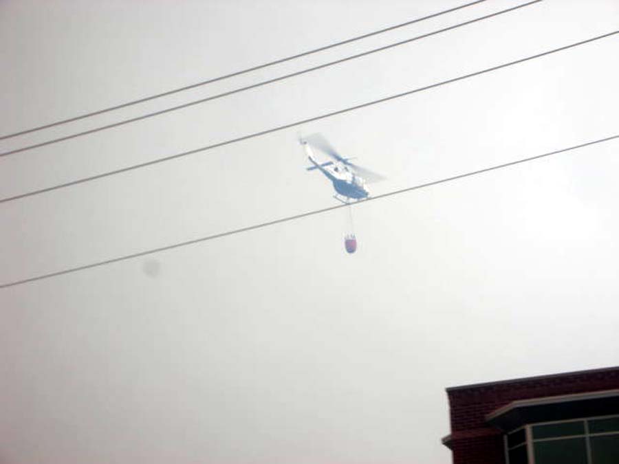
More May
16 Photos
PINEYPOWER's
Blog of the Fire
May
15,
2007
7:35p.m.
I received reports that Pinewood Estates and much of Fawn
lakes, both adult communities on Route 72, were evacuated.
12,000 acres have burned so far.
8:55p.m.
I live off West Bay Ave., a half mile west of the Garden State
Parkway, in Barnegat. I tried to leave and go east for a scheduled
meeting, but the road is blocked off. Westbound traffic is
being diverted to Lighthouse Drive and I'm guessing traffic
from Route 72 Westbound is being diverted to Nautilus Drive
in Stafford, then to east on W. Bay Ave. in Barnegat. The
eastbound lane is gridlocked as well, but some kind soul let
me through.
It was eerily quiet, and many people - mature adults - were
walking west on the road. I stopped one couple, who told me
they left their car on the Parkway because it was gridlocked,
and were walking home to get their dog. At that point I decided
my pets were more important, and attempted to turn around,
and had a State Trooper yelling at me as I did. I felt bad
but they have their hands full, so please try to cooperate
with them! As I write this, sirens are still wailing from
time to time, but the wind seems to have died down a bit.
10:00p.m.
Things have quieted down. My sources tell me Horizons Adult
Community was evacuated, but Pheasant Run was not. In my opinion,
I think that at least for now, all is ok. Both are located
on W. Bay Ave. in Barnegat, just a short distance from my
own home.
Local information is limited at this hour, but 100.1 WJRZ
FM is trying to keep everyone updated. I walked to W. Bay
Ave., and it's no longer gridlocked, but general detours are
still being made. It seemed like Police were permitting local
residents to return home.
10:30p.m.
For the first time today, I can smell smoke. At last report,
the fire was only 10% contained. It's alarming that we have
no information at this time as to containment, evacuations,
etc., other than occasional reports from 100.1FM. I tuned
into Fox Philadelphia on my tv, and they're talking about
a "Fish and Flush" toilet bowl, while a forest fire
rages in Southern New Jersey. WJRZ is still my main source
of information right now. At least the wind has died down
to almost nothing, although the smell of smoke is getting
stronger.
11:30p.m.
I drove west on W. Bay Ave. The road is still closed at Route
72. The smoke is much stronger than this afternoon when I
took the photos, and gets worse as one travels towards Route
72, but the wind has died down, which may be a factor. I did
not see any orange glows indicative of fire, so I'm feeling
better, in spite of the smokey smell that's permeating everything.
The sirens have stopped wailing, so I'm hoping the fire is
being contained by our gallant forest fire fighters.
NJ
Channel 12 has reports on Comcast Channel 62, but I'm not
sure how updated it is. Keep tuned to WJRZ 100.1.
Midnight
- The air is very still, but the smell of smoke seems stronger.
Apparently, a flare from an F16 at the Warren Grove gunnery
range caused the fire. Ocean Acres west of Breakers Drive
has been evacuated...a total of 2,500 homes have been evacuated,
according to NJ12. Fortunately, no injuires have been reported.
May
16
7:45a.m.
- Officials report that 13,500 acres have burned so far. Go
to (defunct link) to view photos taken about 10p.m. last night,
accross Route 72 from the WAWA and the Stafford Diner. It
is a controlled back burn. Photos Courtesy of "Nick",
who lives in that area.
Map
of general area of fire: west of the GSP, south of Route 72
and north of Route 539 (Whiting Rd.)
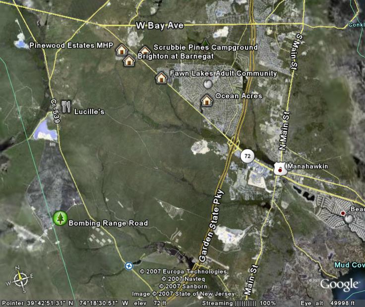
Click
map to enlarge
11:00a.m.
- I just drove to Route 72 and Nautilus, where Southern Ocean
Community Hospital is located. It's extremely hazy, but I
did not see any smoke in the immediate area. I did see evidence
of the control burn on the south side of Route 72.
I
was just told that fire has sprung up further west on 72,
across from the WaWa, and the store is closing, and the immediate
area is being evacuated. I have been told that Route 72 is
again backed up.
12:45p.m.
- TV12 reports that two homes at "Brighton at Barnegat"
have been destroyed and more damaged, but there have been
no reported injuries. Latest reports have the fire 30% contained,
but there is great concern over the increasing wind.
Over
1,000 brave men and women have responded to this fire, mostly
volunteers, from all over the State. We owe much to them.
The next time you see a firefighter, local or State police
officer, first aider, or one of the many volunteers who risk
their lives to protect you, please say "Thanks".
And during this emergency, please cooperate with them!
I
just received notice that Route 72 is once again closed from
Lighthouse Drive (or the GSP) westward but unsure of the end
of the closure at this time.
2:00p.m.
- Traffic is again backed up on W. Bay Ave., eastbound. It
looks like traffic is being redirected from Route 72 to Nautilus
Drive, and then east on W. Bay to either Route 9 or the GSP.
2:30p.m.
My sources tell me that Mirage, Pheasant Run and Heritage
Point are being evacuated. Route 72 is closed at Doc Cramner
Boulevard; apparently no one can even get on the Parkway.
Another source told me fire was as close as a half mile from
Recovery Road in Stafford Twp. Right now, I'm seeing black
ashes for the first time in my own yard. I notice that the
birds are feeding heavily in the feeders outside, as if in
preparation for flight.
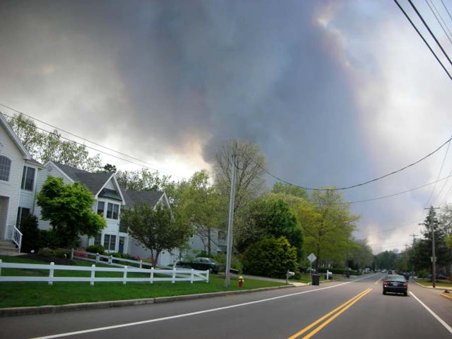
4:00p.m.
- This may be my last report for some time. I heard evacuation
commands on other streets, and expect mine soon. I've heard
RUMORS that the Ocean Acres area of Barnegat has been evacuated.
Sirens are wailing once again.
5:00p.m
- Southern Ocean Medical Center has NOT been evacuated. There
are ambulances on standby but no action is being taken at
this time. Things have quieted down suddenly; no more sirens
or loudspeakers. Horizons, Heritage Bay and Pheasant Run have
been evacuated, from what I understand; but I've heard conflicting
reports on Mirage.
Thanks
to everyone who has emailed or posted a message to thank me
for my makeshift Blog. I'm glad I can be of help to those
of you who aren't getting many details. I'll keep it going
as long as I can.
6:00p.m.
- We're supposed to evacuate, but West Bay Ave. is gridlocked
in both directions. Right now, the sky is getting black; I
hope it's the storm approaching and not a smoke cloud. The
Parkway is presently open, but may close from Toms River to
Atlantic City if smoke impairs visibility.
6:50p.m.
- IT'S RAINING!!!
8:55p.m.
- It's still raining steadily. The air smells of wet, charred
pine, and it smells divine. I feel confident that the danger
has passed.
Again,
enough cannot be said for all the brave people who fought
this stubborn fire, and all the behind-the scenes people that
have done so much for their fellow humans. Thanks to all of
you - you know who you are.
MAY
17
11:30a.m.
- The fire is over 70% contained. The air outside has no smell
of fire, just the scent of fresh spring air in the Pine Barrens
after a rain. All roads are open. Our firefighters aren't
done yet, due to possible flareups of smoldering trees, but
the threat to homes is about over. Fortunately, there were
no injuries reported, but both Pinewood Estates and Brighton
at Barnegat suffered damage, with reported five homes totally
destroyed. Thanks to the firefighters of so many surrounding
communities volunteering many grueling hours, most homes were
saved. If anyone can supply me with a list of the towns that
sent help, please EMAIL it to me!
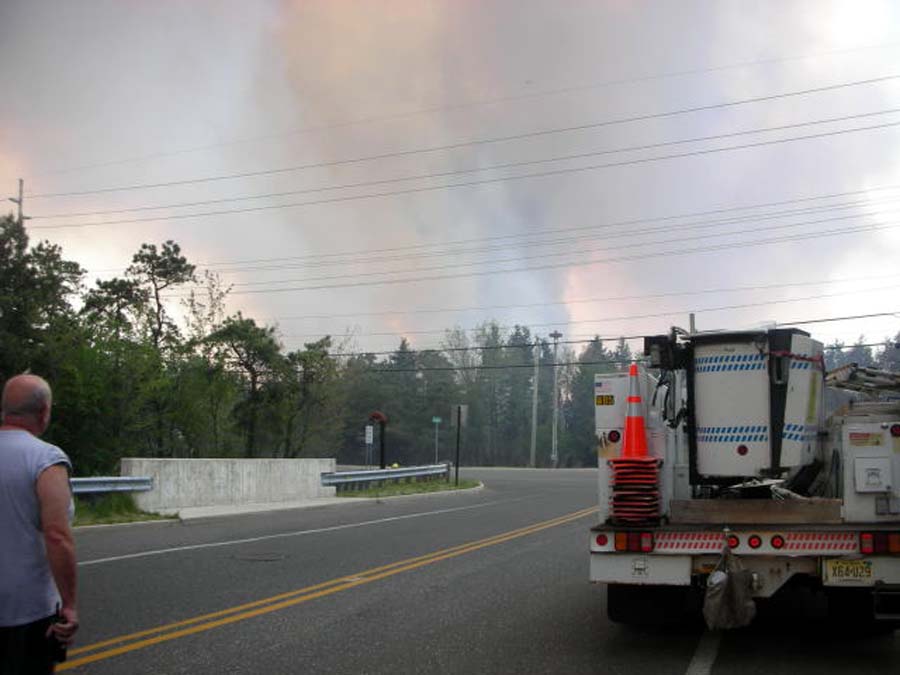
2:45p.m.
- I just returned from a perimeter ride around the forest
fire area (W. Bay Ave., (C.R.544) to W. on Route 72, Left
on Cedar Bridge/Warren Grove Road, and Left (south) on Route
539, then North on the Parkway and West on Route 72.Along
the way, I was amazed at the amount of controlled back burn
that was done, and how close to several large homes and horse
farms it was. This back burn saved hundreds, maybe thousands
of homes that otherwise would have been swallowed up by the
fire.
I
cannot emphasize enough how vitally important controlled burning
is, both to the survival of our beloved homes and to our beautiful
Pine Barrens. The New Jersey Forest Fire Service must be commended
for their efforts throughout the year, from late Autumn through
Spring when they strive to perform the controlled burns. Please
support them in any way you can!
I was relieved to see that the Village of Warren Grove was
untouched, and the famous Lucille's was packed as usual with
diners! As the homes dwindled, I neared the area of the major
fire, and was saddened to find charred remains as far as the
eye could see, and fire also burned at least part of the West
Penn Pygmy forest. (photos to follow)
I
spoke with Felix Martinez, the NJ Bureau Chief of NBC 4, who
was with a cameraman filming the devastation. He told me that
Lucille's staff had kept them well fed during the ordeal.
Kudos to Lucille - Pineys are the BEST!
NJ
Forest
Fire trucks were still in and out of Bombing Range Road, so
I didn't venture in, not wanting to be in the way. Further
south on Rt. 539, I saw more evidence of back burn, but it's
possible the fire was that far south.
Back
on Route 72 in Stafford Twp., I began to see back burn west
of the Parkway, with what looked like had been occasional
flare-ups of the fire. The only evidence of current fire I
could see was some white smoke (a good thing) south of Route
72. I couldn't see much of Brighton or Pinewood from the road;
I'm guessing the damage was done in the rear of this adult
community, away from the highway.
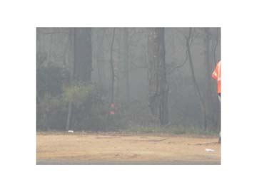
Please
check back in about an hour, when I should have photos of
the fire posted.
4:00p.m.
- Photos of the aftermath
are now up.
In
spite of the devastation, fire is the main way the Pitch Pines
(pinus rigida) regenerate. The heat forces the cones open,
and seeds are then disbursed. (see photo on next page) The
charred ground supplies nutrients, and the new-found sunshine,
previously blocked by towering oaks, provides light for growth.
Soon this alien-looking 17,000+ acres will be home to sprouting
pines and some of the burned trees will have pine needles
sprouting from their trunks. The forest floor will see new
growth of various plants, some of which may be rare or endangered
species that will now thrive with the sunlight.
So
the cycle continues.This is the magic of nature.
I
have been informed eric Eric of Ocean Acres that the white
smoke I reported seeing on Thursday was that of the mulch
/ compost pile smoldering at the recycling center on Recovery
Road.
MAY
19
Now
that the fire is over, the controversy over the bombing range
is sure to grow. Personally, I'm "on the fence"
about it - where else can training take place in such a wide
open area on the east coast? In today's world, I feel a bit
more comfortable knowing our forces are stationed close enough
to defend our immediate shores. On the other hand, the population
in the area has increased substantially on the perimeter of
the Pine Barrens over the past 5-10 years, and the "incidents"
that have occurred are quite unsettling. It seems that at
a minimum, more stringent safety regulations must be enforced,
but I don't have any knowledge of military air procedures.
|


