|

Parks
and Forests
in the NJ Pinelands
|
|
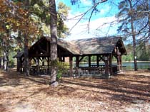
Wells
Mills County Park
Route 532, Waretown NJ
609-971-3085
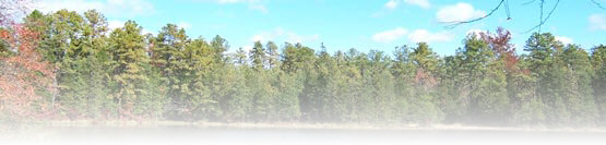
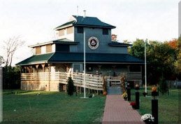
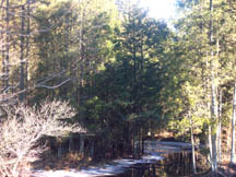
The first stop for anyone interested in learning about the ecology
of the Pine Barrens should be Wells
Mills County Park in
Waretown. Here you will find 900 acres of pristine pinelands,
a cedar-spring fed lake with canoe rentals, and a three-story nature
center. There are loads of programs at the park, as well as
van tours of the region, canoe trips, and much more. Or, just
take a walk through the miles of hiking trails. But be careful...you
never know when the Jersey
Devil will show up!
(east)
|
|
|
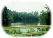
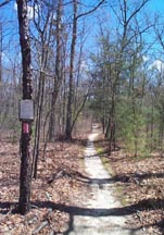
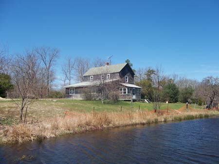
Eno's Pond County
Park
East Lacey Road, Forked River, NJ
Eno's
Pond County Park
in Forked River has history dating back to the colonial days.
Originally a luxury resort geared towards fishing for the rich and
famous, the Ocean County Board of Chosen Freeholders bought this
land and developed it into a recreational area which focuses on
the famed "Eno's Pond". Once used for making ice for guests,
the pond and surrounding woodlands are now a haven for many unusual
species of flora and fauna. These 28 acres are rich in ecolocigal
resources. Eno's Pond County Park now has scenic trails, and
two panoramic overlooks of the pond. Picnic tables are scattered
throughout, and a playground and open playing field complete the
picture. It's located on East Lacey Road, a few hundred yards
east of The Captain's Inn.
(east)
|
|
|
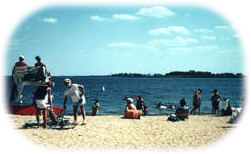
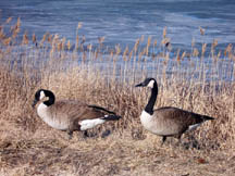
Berkeley
Island County Park in
Berkeley Township offers a free swimming beach on the Barnegat Bay,
with Ol' Barney standing tall
on the east shore. The park also offers picnic facilities,
a playground and a large fishing and crabbing
pier. Call 1-877-OC PARKS for details
(east)
|
|
|
Wharton
State Forest
4110
Nesco Road Hammonton, NJ 08037
Batsto Office: (609) 561-0024
Atsion Office: (609) 268-0444
Wharton
State Forest is the largest single tract of land within the New
Jersey State Park System, with 122,463 acres. It is also the site
of Batsto
Village, Atsion Historical area, and many "lost towns"
of the Pines. Swimming facilities are available in season at Atsion
Recreation Area. There are many access points to the 50-mile Batona
Trail throughout Wharton. Campsites, canoeing, available.
(central)
|
|
|
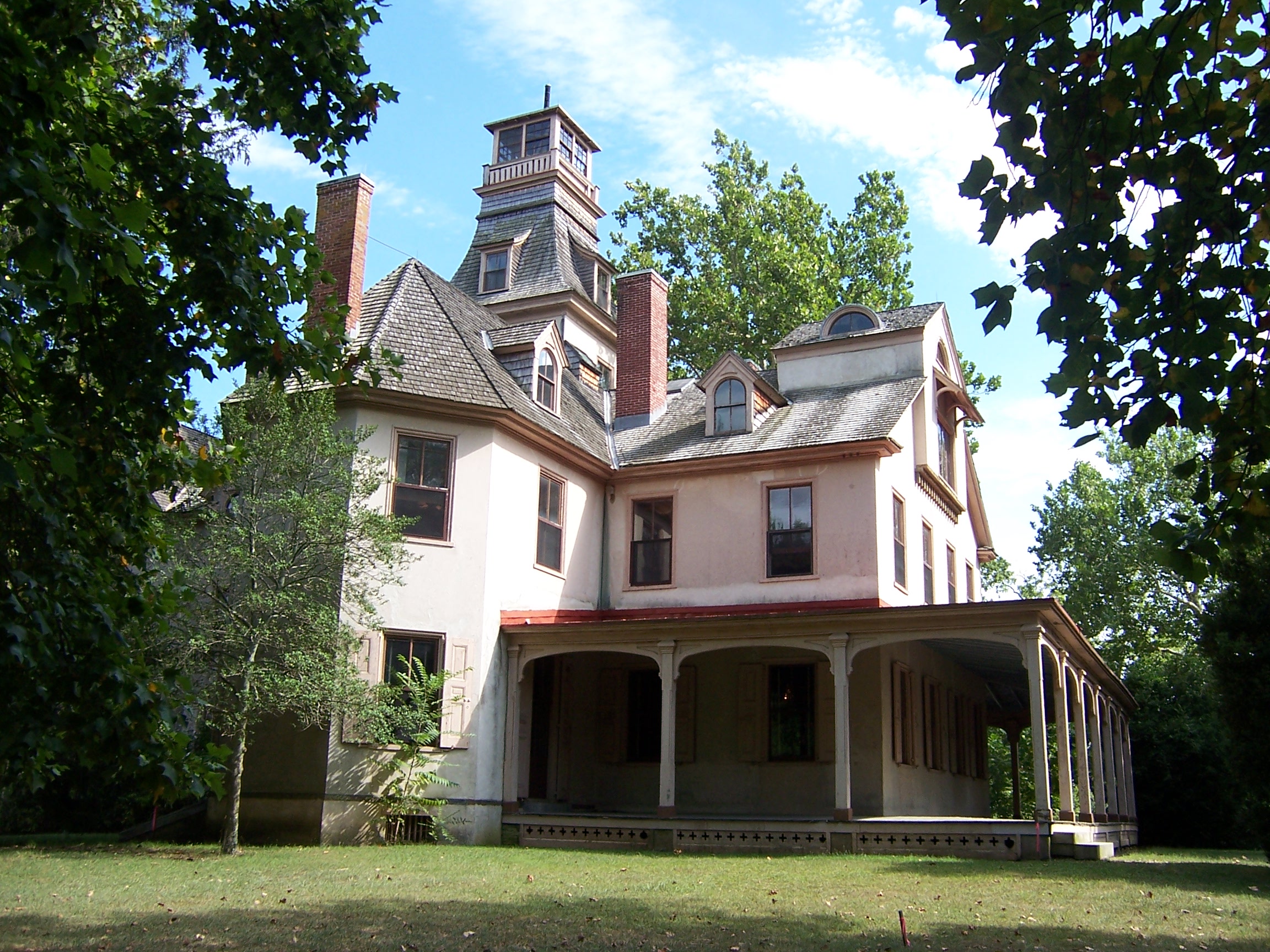
Batsto
Village
31 Batsto Road Hammonton, NJ 08037
Batsto Office: (609) 561-0024
Founded
in 1766, Historic
Batsto Village
in Wharton State Forest in Burlington County
is a recreationof
a bog iron refining town. Bought by the State of New Jersey
in the 1950's, it has been restored and now features a visitors'
center, barns, shops, the original mansion, and more. It is now
considered a "living history museum" because of the many
exhibits and demonstrations which take place there. Mansion tours
are available Fridays and Saturdays. Call 1-609-561-3262 for hours,
fees, and program information.
(South)
|
|
|
Double
Trouble State Park
Route 530, Berkeley Township, NJ
(732) 341-4098
GPS Coordinates DMS 39° 53 52.36 N 74° 13' 16.65" W
Double
Trouble is the site of a working
cranberry farm, with many partially restored buildings of
the old village. Almost 8,000 acres, it also contains a wonderful
nature trail through cedar forests, across Cedar Creek and around
the cranberry bogs. Purchased by the state of New Jersey in 1964,
it is on the State and National Registers of Historic Places.
(east)
|
|
|
Ocean County
Park
Route 88, Lakewood, NJ 08701
732-506-9090
Northern Ocean County is home to Ocean
County Park, in Lakewood Township. This 300+ acre
park was once the home of Billionaire John D. Rockefeller. It features
a fresh-water swimming lake, tennis courts, ball fields, plenty
of picnic facilities and more. Call 1-877-OCPARKS for more info.
(north)
|
|
|
Brendan
T. Byrne State Forest
Route 72, P.O. Box 215 New Lisbon, NJ 08064
(609) 726-1191
GPS Coordinates DMS 39° 53 27.66 N 74° 34' 46.63" W
More details and photos
Formerly known as Lebanon State Forest, visitors to BTB State Forest
are greeted by the fresh scent of pines. Today's forested acres
are a strong contrast to the barren, cleared land that existed in
the 1800s. The Lebanon Glass Works was established in 1851 and was
successful until 1867, when it shut down after depleting the supply
of wood necessary for the furnace to operate. Today, hikers can
follow the sandy trails and roads that crisscross the forest, sometimes
passing near the remains of stone or brick structures, or where
large depressions indicate the location of what was once a bustling
town. Pure, iron-rich streams flow through acres of swampy land
covered with dense stands of Atlantic white cedar.
(north/west)
|
|
|
Bass
River State Forest
762 Stage Rd Tuckerton, NJ 08087
(609) 296-1114
Burlington and Ocean Counties
GPS Coordinates: DMS 39° 37 14.30 N 74° 25'28.83" W
Bass
River S.F. is home to Lake Absegami for swimming, boating and canoeing.
A trail through the Absegami Natural Area wanders through a pine/oak
woods and a small Atlantic white cedar bog. The West Plains Natural
Area (Pygmy Pine Forest) and access points to the 50-mile Batona
Trail are also within Bass River. Campsites available.
(south/east)
|
|
|
Edwin
G. Forsythe National Wildlife Refuge.
Great Creek Road, Oceanville, NJ
More than 43,000 acres of southern New Jersey coastal habitats are
actively protected and managed for migratory birds. Several locations
along the Jersey coast. The 8-mile loop road and trails at Brigantine
are open seven days a week from sunrise to sunset. (call first)
(south/east)
|
|
|
Barnegat
Lighthouse State Park
P.O. Box 167 Barnegat Light, NJ 08006
(609) 494-2016
GPS Coordinates DMS 39° 45 46.91 N 74° 06' 22.86" W
Located on 32 acres on the Atlantic Ocean at the northern tip of
Long Beach Island. Gorgeous views, trails, picnicking, fishing,
birdwatching, Interpretive Center.
(east)
|
|
|
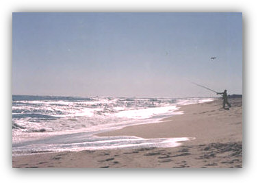
Island
Beach State Park
P.O. Box 37 Seaside Park, NJ 08752
(732) 793-0506
GPS Coordinates DMS 39° 54 18.98 N 74° 04' 53.15" W
Located on a barrier island, accessible via S.H. 37 E. 3,007 acres.
Pristine oceanfront and bayfront, 10 miles of coastal dunes, nature
trails, protected areas, sugar sand beaches, excellent surf fishing,
MSFV's by permit. Part of the Pinelands National Reserve.
(east)
|
|
|
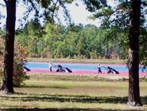
Cloverdale
Farm County Park
Cloverdale Road (off Route 554/W. Bay Ave.)
Barnegat NJ
c/o Wells Mills C.P: 609-971-3085
In
Late 2004, the Ocean County Natural Lands Trust purchased the 80
acre tract of land known as Cloverdale Road Farm in Barnegat. This
property is tucked away off West Bay Avenue, and is a much needed
and appreciated measure to assure conservation. Once a working cranberry
farm, this area is a haven for nature lovers. Wildflowers, birds
and yes, even cranberries are here, all for great photo opportunities.
Nature walks are offered, and plans are underway to start "working"
the bogs once again. Call 609-971-3085 for details. Photos
(east)
|
|
Although technically
outside of the "Pinelands Management Area, Allaire State Park
in southern Monmouth County is probably best known for its historic
19th-century ironmaking town, Allaire
Village. The antique steam trains on the Pine Creek Railroad
are also well-known. The Manasquan River, which winds through the
park, attracts canoeists and fishermen. The rivers floodplain provides
habitat for over 200 species of wildflowers, trees and plants as
well as habitat for birds and other wildlife. Hikers, mountain bikers
and horseback riders enjoy the many trails in the park.
(north)
|
Franklin
Parker Preserve
Woodland Township, Burlington County NJ
Formerly a cranberry farm, this 9,700 acre tract was purchased
by New Jersey Conservation Foundation in December 2003, after
owner, A.R. DeMarco Enterprises, decided the property should be
protected forever as a nature preserve. NJCF was able to cover
most of the propertys $12 million cost. The area is a biologist
and enviornmentalist's dream, as it is home to many threatened
and endangered species. See map.
(central)
|
Warren
Grove Recreation Area
Beaver Dam Road
Warren Grove, Ocean and Burlington Counties
c/o Bass River State Park - 609-296-1114
Warren Grove Recreation
Area is an undeveloped wilderness perfect for hiking and birding.
This 617-acre parcel is just west of the town of Warren Grove
and straddles Ocean and Burlington counties. The land was acquired
from the National Park Service in 1972 as part of their Federal
Lands to Parks Program. Bass River State Forest administers the
area. Warren Grove Recreation Area is open for passive recreation
including horseback riding, bicycle riding, hiking, birding, hunting
and nature/ecology study. A small parking area is being planned
along Beaver Dam Road across from the Federal Aviation Administrations
tower site. Access into the recreation area is via several sand
roads and old woods roads through the area but no marked trails
currently exist. The recreation area also is home to the federally
endangered broom crowberry (Corema conradii) and other rare plant
species. View the Dwarf Pine Plains habitat, a globally rare forest
community, where the pitch pine trees reach an average height
of only 4 to 5 feet.
|

© 1998-2017
PineyPower.com
Barnegat NJ 08005
Owner-Webmaster: Cathy Antener
Please
note: Unless
otherwise noted, all articles and photographs on this site are the property
of PineyPower, and as such, may not be reproduced without written permission.
Thank you.
|

